Grunt and Glory: Seven Lakes Basin Loop
- Bob Pepin

- Sep 7, 2020
- 6 min read
Updated: Sep 26, 2020
For the last year we have been hearing about the Seven Lakes Basin/High Divide Loop. Foiled in our attempts to get national park camping permits for a two or three day backpacking trip to explore the Basin and High Divide, Sharlene, our daughter Katharine, her friend, Gabby Brulotte, and I couldn't stand it any longer and did the Loop one glorious August Saturday.

Descriptions promised 19 miles of rain forest, steady climbs to the Olympic's version of alpine meadows, breath-taking, near vertical valley walls dropping thousands of feet, and "the best view of Mount Olympus on the Peninsula." Judge the view for yourself. I haven't seen them all but just can't imagine how there could any be better. The jagged, glacier encrusted pinnacles of Olympus, it's white, river-like Blue Glacier curling down on the left, squat at almost 8,000 feet above the Hoh River Valley. Not that many miles down river you'll find the Hoh Rainforest, said to be the largest temperate rainforest in the continental U.S. and a "must see" on the Peninsula. They get 12 feet of rain a year there at the National Park's Hoh visitor center. That's right, 12 feet of rain to join the cloudy, glacial runoff in the wide, cobbled Hoh River before it empties into the Pacific just a bit downstream. But that is a different story and the Loops starts 10 miles or so before Olympus gave us this.

The Loop basically starts here, or actually .7 or .8 from here at the Sol Duc Falls parking lot. This is a national park with masses of visitors, and the 1.5ish round trip between the falls is listed as a "must do." It's an easy, comfortable hike. (Unless, as we learned, the .7 is the last of a 20 mile day.) A firm, flat, lush journey past the massed growth of nursery logs, centuries old Douglas Fir and Red Cedar, engrossing, twisting root mazes, and the sound of rushing water ending at the triple-tined falls, the walk to the falls is special and worth the effort. For the back packers and day hikers heading deeper into the forest, Sol Doc Falls offers an excited welcome; and a nudge as you head up hill, following the rocky cut carved by Canyon Creek toward Deer Lake.


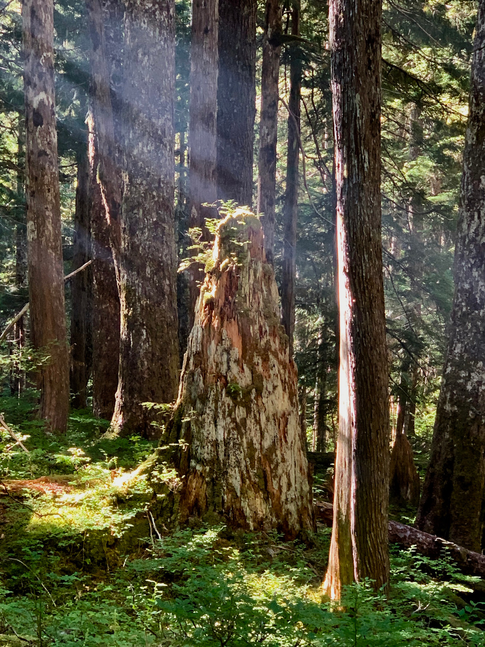


Its about three miles of steady climbing on a good trail to get to reach Deer Lake. I've heard complaints that hiking in these forests is boring, nothing but tree after tree after tree. The tree after tree after tree part is true, but I can't understand the boring. Every turn in the trail seems to offer something new to wonder over. This stretch, for instance. Canyon Creek, with its steady cascades, its mossed rock, its borders of Devil's Club and Huckleberry; the mesmerizingly rod-straight, parallel groves of hemlock or cedar or fir marching up steep hill sides; trees pregnant with burls, diseased, disfiguring, and magic; snags (dead trees) and stumps, rotting, host to ferns and lichen, welcoming the rare comfort of sunbeams to the forest floor; ending with the mirroring beauty of Deer Lake itself, which boosts you toward the next 4 or so mile stretch, onward to Seven Lakes Basin.


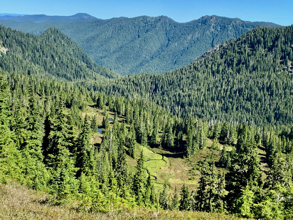


The trail climbs and climbs and climbs, wandering through these quiet hollows, not much water now but filled with the rusty blush of Red Mountain Heather, there, laid out in front of Shar. Higher and higher, little mountain lakes and ox-bow streams appearing in the valleys we'd left behind, we came onto a ridge line anchored by these crazy twisting, curving works of art. Western Hemlock, of all things. We'd never seen the like and one of these days can maybe figure out what caused them to take such form. If anyone knows, I'm all ears. Although we'd heard that we were just past the height of the wild flower season, there were plenty, as this chubby Olympic marmot surrounded by Indian Paint Brush and daisies can attest. For those of you who haven't been out here, these particular marmots are only found on the Peninsula, part of the Galapagos Island effect caused by the OP's isolation during the thousands of years of ice ages. There are a number of such critters. Back to the wild flowers, thanks to this new Seek app we're using we identified Tundra Aster, Mountain Spiraea, Mountain Bog Gentain, Edible Thistle (really??), Woodland Beardtongue, and more. The ridges above eventually began to get closer, more sparsely forested, rockier.


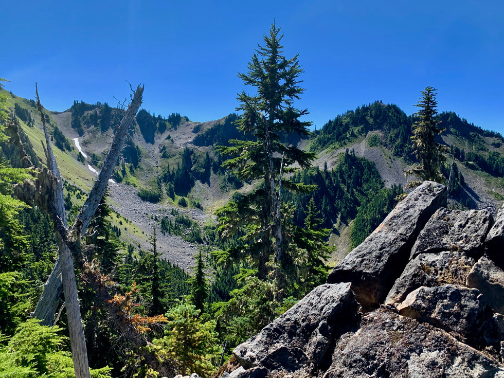
Olympus started to rise up above the ridge lines across the way and, as we worked closer, jealously claimed more and more of the sky; as it did with this pretty little pass we were steadily working the visible trail toward. The photo on the right is from beyond that pass, looking across the Hoh River to the steep, green hump leading from the Olympus monolith (as I thought of it) down to the Hoh's valley floor.

Then finally, as we worked our way around and past Bogachiel Peak, there was Seven Lakes Basin, home of beauty, bears, and coveted, permitted backcountry camping spots. We did not go down to the lakes, saving that for a time when we can actually pitch camp, but turned left at a junction with a trail that would have taken us the six or seven miles to the Hoh River, and lunched on the High Divide, unable to take our eyes off of the amazing Olympus, square in our face. It would confidently ignore us for the two miles we followed the ridge line trail along the Divide, winding back and forth, from one side of the ridge to another, now above the Basin to our left, now shadowing the Hoh far below to our right. Here are the ladies, maybe half way along the Divide, meadow of lupine and daisies, the river far below, Olympus hogging the shot. Happy and half-way done.

The Loop drops off of the High Divide after passing Seven Lakes Basin and hovering above a smaller bowl, Sol Doc Park, I think it's called. There in the little bowl sits Heart Lake and the Loop winds around the bowl, past Heart Lake, down along Bridger Creek until it becomes part of the Sol Doc River, which eventually makes Sol Doc Falls and the end of the Loop. Of course, that is 8 or 9 or more miles down and we were already foot sore and plenty tired, thank you. Kat and Gabby had cruised well ahead of Shar and me. They were swimming in the lake by the time we got down. Shar plunged her feet into the water and seemed so happy that I followed suit, thank goodness. The real treat of that bowl, and one of the reasons we were so far behind, was that some folks had spotted a bear eating its way through the meadows above the bowl and we'd watched it. The binoculars Shar was carrying were suddenly worth their weight, and the bear was still visible from the lake so we all could watch, especially Kat...the consummate lover of bears. Maybe the most important thing about Heart Lake is that we could use our LifeStraw bottles to fill up on water. We'd run out and needed it badly.

Fortunately, both Bridger Creek and the streams dropping toward the Sol Duc allowed us plenty of opportunity to fill our containers. The water was cool, sweet, and offset the grind of those last miles. And a grind it was.


By the time Shar and I hit the crossing trail, we had only seen four people for three or more hours. We assume that it was all beautiful, but all I can really say for sure is that it was well shaded and cool. We were still an hour out, when Kat and Gabby reached the truck in the Sol Duc Trailhead parking lot, and we were already foot sore enough for a small army. That last .7 of a mile, flat and easy, seemed to last forever. It was full of energetic Covid masked tourists making their big trek to Sol Duc Falls. I was happy to see so many out, enjoying all of this, and tried not to hope that they were jealous for only having such a tiny portion of the Loop to enjoy. Maybe some of them wondered at the sign "Seven Lakes Basin Loop." After all, I had, and now I know. An incredible, near 12 hour, 20 mile day in the mountains, which we wouldn't have passed up for the world.


Come on out, Jay. There's lots and lots to explore without having to wear the feet and knees to their nubs. I promise.
Wow, 20 miles, 12 hours! Definitely not for the faint of heart or weak kneed. So I'm especially grateful for the great shots and narrative.
Thanks, Sharon. You will love this little hike.
Wow. I am inspired. It’s on my list.... if not this year..... definitely 2021.
Great blog. Thanks
Glad you enjoyed it, Susie. Clearly country you'd appreciate. No worries about 20 miles. This place is full of trips as long or short as you'd like. Would be delighted to share any of them with you.